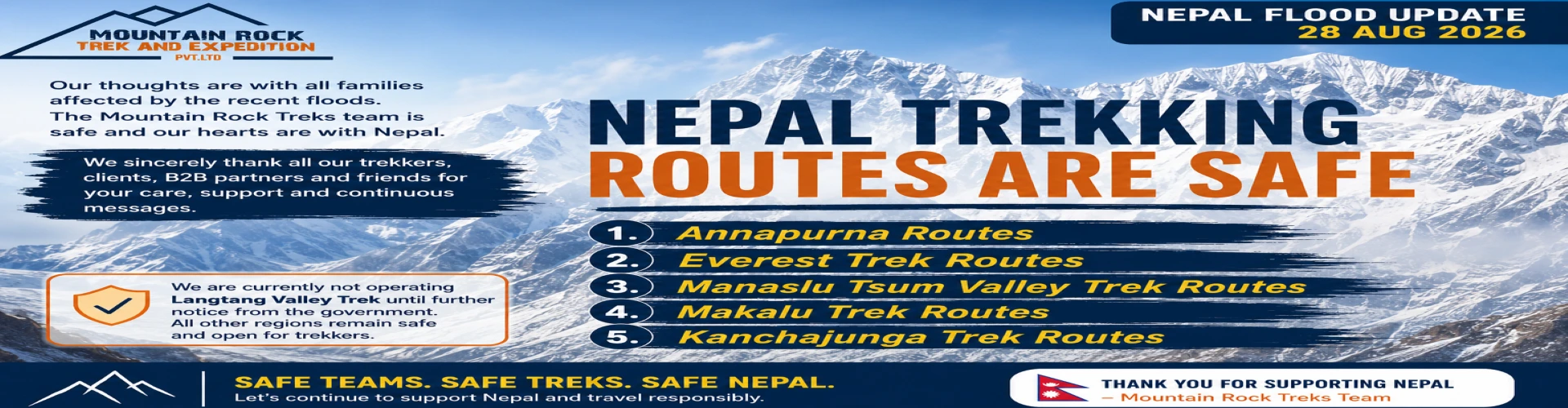
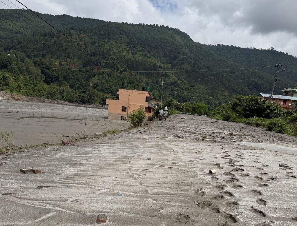
On August 26th, 2026, the flood mainly impacted areas such as Langtang and Rasuwa, the Syabrubesi and northern Rasuwa corridor; therefore, trekkers who intend to follow the standard Kathmandu to Syabrubesi route should take great care to verify with a trusted Nepali source prior to setting out. On the flip side, these areas were the only ones, aside from certain isolated pathways throughout the country, that experienced these catastrophic flood occurrences.
The popular trekking areas, Annapurna, Everest, Manaslu, and Kanchenjunga, along with others, are in geographically dissimilar locations and insulated from disaster in areas such as Annapurna Base Camp; while traveling the standard roads shall be fine as well, but may take additional days to gain passage throughout the immediate monsoon recovery period due to damaged roads from Kathmandu.
Alternative means of transport for those traveling to the Langtang region will be via Sundarijal-Chisapani-Tharepati-Gosaikunda, which will connect to the main Langtang Valley trail, but this, as well, should be investigated as roads will need their paths assessed. Simply put, the flood impacted a few corridors, not the trekking paths throughout Nepal.
Which Trekking Regions in Nepal Remain Safe for Autumn/ Spring?
While trekking in Nepal is still possible, the choice of the route is now crucial and depends largely on the trekking corridor and the access to the trailhead. Latest updates on routes suggest that the Annapurna, Everest and Manaslu are the preferred options for the autumn season, while the Langtang and Rasuwa corridor requires extra caution due to the damage to the infrastructure and changing access rules.
For those who have already planned a Langtang trek, we advice to think of an alternative only after checking the most recent trail, bridge and road conditions with local authorities and guides. Below you will find a useful summary of the different trekking routes, including access by road or flight and remaining concerns due to flooding.
Trekking Route
Main Starting Point
Usual Access From Kathmandu
Current Flood Impact / Access Situation
Recommended Travel Option
Langtang Valley Trek
Syabrubesi
Road via Dhunche and Rasuwa
Directly impacted. The Rasuwa region corridor and infrastructure around the traditional approach were severely damaged.
Use an approved alternative route after current trail verification
Gosaikunda Trek
Dhunche / Sundarijal
Road or short trek approach
Impacted on the north access side, with changing conditions after the flood.
Consider Sundarijal to Chisapani to Tharepati approach where confirmed open
Helambu Trek
Sundarijal
Short road drive
Generally more accessible given it approaches from the Kathmandu Valley as opposed to the damaged Rasuwa.
Road + trek
Annapurna Base Camp Trek
Pokhara / Ghandruk
Flight or road to Pokhara
Not in the main flood-impacted corridor, but with local weather and trail conditions requiring checks.
Fly Kathmandu to Pokhara when road conditions are unreliable
Ghorepani Poon Hill Trek
Pokhara / Nayapul
Flight or road to Pokhara, then road
Not directly impacted by the Rasuwa disaster.
Fly to Pokhara + road + trek
Mardi Himal Trek
Kande / Dhampus
Flight or road to Pokhara, then road
Outside main flood-affected corridor.
Fly to Pokhara + road + trek
Khopra Ridge Trek
Pokhara / Ghandruk
Flight or road to Pokhara
Outside main Rasuwa disaster corridor.
Fly to Pokhara + road + trek
Annapurna Circuit Trek
Besisahar / Dharapani
Road from Kathmandu
Main trekking region is apart from Rasuwa but with individual road sections vulnerable to monsoon impact.
Check road conditions before departure; flight to Pokhara can reduce Kathmandu road dependency.
Everest Base Camp Trek
Lukla
Flight Kathmandu to Lukla
The Rasuwa flood did not directly impact the main Everest trekking corridor.
Flight to Lukla + trek
Gokyo Valley Trek
Lukla
Flight Kathmandu to Lukla
Separate from the main flood-impacted corridor.
Flight to Lukla + trek
Everest Three Passes Trek
Lukla
Flight Kathmandu to Lukla
Not directly impacted by the Rasuwa flood but with high altitude weather a key consideration.
Flight to Lukla + trek
Manaslu Circuit Trek
Machha Khola
Road from Kathmandu
Outside of the main Rasuwa flood zone but with access roads and bridges still requiring current verification.
Road + trek, with flexible transport planning
Tsum Valley Trek
Machha Khola
Road from Kathmandu
Separate from the main disaster corridor, but with remote road conditions requiring checking.
Road + trek
Kanchenjunga Trek
Taplejung
Long road/flight combination
Far east of the main flood-affected region. Remote access means conditions need careful checking.
Flight/road + long trek approach
Makalu Base Camp Trek
Num
Road/flight combination
Not in the main Rasuwa flood corridor but with remote access potentially weather-sensitive.
Road/flight + trek
Upper Mustang Trek
Jomsom
Flight to Pokhara, then Jomsom or road
Geographically isolated from the flood zone.
Flight to Pokhara + Jomsom flight where operating
Nar Phu Valley Trek
Koto
Road via Besisahar/Manang
Not directly within the Rasuwa flood corridor but its remote road approach requires verification.
Road + trek
Panch Pokhari Trek
Dhap / Melamchi side
Road from Kathmandu
Closer to the central impacted area than Annapurna or Everest; therefore, current local access verification is essential.
Road + trek after route verification
Which Trekking Regions Are Currently Affected?
Langtang Region and Rasuwa
The Langtang region is the main trekking region affected by the August 26 flood. The ancient gateway to the Langtang Valley, Syabrubesi Peak, was severely damaged. The road from Kathmandu towards Syabrubesi is also blocked. The trekking trail beyond the Syabrubesi gate is reported to be intact, although access to the trailhead is still the main concern.
We advise our guests who are still considering treks to Langtang not to risk going via the flooded region. An alternative route can be found depending on the road and trail conditions, which can be consulted with local authorities.
Gosaikunda and Helambu connection
Gosaikunda trekking region should also be approached with caution as the access route to Gosaikunda from Dhunche is blocked as well. However, Gosaikunda has an alternative route from the Kathmandu valley through Sundarijal, Chisapani, Kutumsang and Tharepathi. This would imply using the Helambu side as an entry point to Gosaikunda. However, it should be noted that access to Helambu could also be affected by unpredictable flood conditions.
Current advisory suggests avoiding the Rasuwa region, including Langtang and Gosaikunda trekking regions, if possible, and only attempt the trek once the conditions have been checked by local authorities.
Annapurna region
The Annapurna trekking trails were unaffected by the flood in Rasuwa/Langtang. Trekkers at Annapurna Base Camp were reported safe, while general trekking conditions suggest that the trails to Annapurna Base Camp are open.
The main challenge for the Annapurna trek is the transportation from Kathmandu to Pokhara. Instead of relying on the road conditions between Kathmandu and Pokhara, we advise our clients to consider the flight option from Kathmandu to Pokhara. From Pokhara, we suggest consulting the road/ trail conditions of your preferred trailhead before arriving in Pokhara.
For ABC, the Pokhara → accessible trailhead → Ghandruk/Chhomrong → Dovan → Deurali → Annapurna Base Camp corridor is still the preferred trekking route, with the trail conditions changing dynamically and depending on the local conditions at the time of trekking. The Annapurna region is therefore a viable alternative for trekkers who wish to avoid the affected region.
Langtang Valley Trek Status After the 2026 Flood: Open
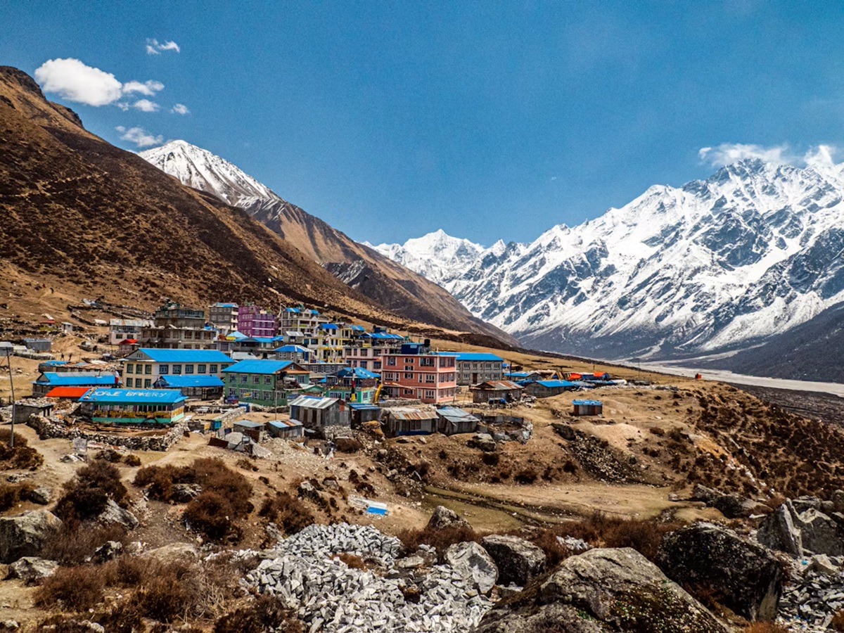
Langtang Valley Trek, Kyanjin area
Is the Langtang Valley Trek Still Possible?
Yes, the Langtang Valley destination in itself is not closed, but the access route via Syabrubesi is the issue at the moment. The recent glacial flood disaster on August 26 has badly affected Syabrubesi and the roads and bridges around the area. Hence, the usually opted route from Kathmandu to Syabrubesi is not safe for now unless the government and trekking agencies deem it open.
Therefore, if someone is still interested in flying to Kyanjin Gompa, it would be better to seek an alternate route. Recently, trekking agencies have come up with a new trail to reach Langtang from the south via the Gosaikunda and Thulosyabru area. However, it is better to check with the authorities whether the trails, bridges, and weather conditions are appropriate to trek.
Alternative Langtang Valley Route via Gosaikunda
The alternative route that is being mooted currently, and which has so far been proved to be viable, is the one that avoids the Kathmandu to Syabrubesi road via the damaged section, and instead takes the Helambu and Gosaikunda side to reach Langtang:
Kathmandu → Sundarijal → Chisapani → Kutumsang → Tharepati → Gosaikunda → Thulosyabru → Lama Hotel → Langtang Village → Kyanjin Gompa
So that this alternative involves putting together Helambu, Gosaikunda and Langtang treks, some trekking agencies have put together an alternative route which goes via Chisapani, Kutumsang, Tharepati, Gosaikunda, Thulo Syabru, and then rejoins the Langtang Valley trail.
What is important to note is that this is an alternative route, but it is not necessarily a safe route.
In other words, we would advise checking the local conditions on the trail as well as on the bridges on the route to Gosaikunda, as well as the subsequent route from Gosaikunda to Thulosyabru.
Day-by-Day Alternative Langtang Route
Day 1: Arrival in Kathmandu | Briefing and Gear Check
Arrive in Kathmandu, and you will meet a trekking leader. You will check the gear and have a detailed briefing on our substitute trekking route to establish your best alternative. We will go over day-to-day activities for the trail of departure on the day following.
Day 2: Kathmandu to Sundarijal and Trek to Chisapani
Instead of getting to the northward in the direction of the damaged Syabrubesi road, we have a direct drive to Sundarijal, the alternative starting the hike through the woodland hills, making the gateway to the south side for the route leading to Chisapani, the alternate entry into upper regions.
Day 3 & 4: Chisapani to Kutumsang and Tharepati
We carry on along the Helambu ridge through Kutumsang right down to Tharepati; this leads our trekking from bottomland hills to the upper region of Gosaikunda, the highest part of the region.
Day 5: Tharepati to Gosaikunda
From Tharepati, we will trek towards Gosaikunda, slowly gaining altitude towards the holy alpine lakes. The weather and landscape become more and more challenging at higher altitudes.
Day 6: Gosaikunda to Thulosyabru and Connection to the Langtang Trail
We will descend towards Thulosyabru from Gosaikunda as we attempt to reach the connection between the Langtang Valley trail. It will likely be on one of these two days that we spend time reviewing with local resources the information on crossings and post-flood status.
Day 7: Thulosyabru to Lama Hotel and Langtang Valley
Trek onward to Lama Hotel and the regular trail into the Langtang Valley, following the valley upwards to Langtang Village.
Day 8. Langtang Village to Kyanjin Gompa
Trek up the remaining upper Langtang Valley to Kyanjin Gompa. Visit the traditional mountain villages on your way toward the increasingly spectacular mountainscape leading you to your final destination and what the traveler initially wished to reach by way of Syabrubesi.
Day 9. Kyanjin Ri or Tserko Ri trek; Begin Return Trek.
Spend the morning on an optional trek to one or two viewpoints depending on the weather conditions, personal health, and trail conditions on the morning in Kyanjin Ri, or on the trek to Tserko Ri, a more strenuous trek on this terrain. After your viewpoint excursion, return trek towards the lower parts of the valley.
Day 10/11/12/13: Descend to the Lower Trailhead and Drive to Kathmandu (drive from Thulo Syapru to Kathmandu by 4WD)
Continue the return trek and finalize arrangements for transportation to the lowest point that is reachable, which should be a flexible driving point with respect to the conditions on roads. Travel back to Kathmandu from the point that currently provides a passable roadway that goes far enough up to facilitate connection and travel back to the capital city.
Day 14: Return to International Flight or Next Destination in Nepal
Drive to the international departure airport, or onward to another location to continue your traveling in Nepal if your flight plan permits this to take place.
Is the Annapurna Trekking Region Safe After the Flood?
Annapurna trekking region was not affected by the flood that happened on August 26 in the Nuwakot and Rasuwa area. The flood took place in the vicinity of the Bhote Koshi and Trishuli rivers on the border with Tibet. At the same time, Annapurna trekking trails are located to the west of Kathmandu Valley and involve exploring different river valleys and passes.
We offer a wide range of different Annapurna hikes with various difficulties and diversifications. Annapurna Base Camp, Annapurna Circuit, Ghorepani Poon Hill, Mardi Himal, and Upper Mustang are completely different trails with distinct starting points and involve crossing different river valleys and road systems.
Annapurna Base Camp Trek
The Annapurna Base Camp Trek is one of the most cautious route planning due to possible obstacles, and the Annapurna Base Camp Trek was highly affected by the 2026 monsoon floods, with slides blocking the trail near Syauli Bazaar and the Ghurjung Suspension Bridge being washed away.
Moreover, the Modi and Kimrong Rivers were damaged due to the increased water flow. Although the devastating Nuwakot/Rasuwa flood did not cause these obstacles on August 26th, they can still present a challenge to ABC trekkers. Therefore, an up-to-date local insight into this region is essential prior to commencing the trek. In case one route is closed due to landslides, alternate paths will be found to provide the safest and most reliable option.
Annapurna Circuit Trek
The Annapurna Circuit trek is comparatively unscathed as it meanders through the Marsyangdi Valley from Besisahar to Manang, over Thorong La and down past Muktinath and Kali Gandaki Valley into Jomsom.
The Nuwakot/Rasuwa flood did not directly impact the Annapurna Circuit trek as it follows a completely different corridor with a different set of rivers. As such, Annapurna Circuit trekkers may not see any impact on their trail itself, but rather the access to Besisahar and the road conditions from Kathmandu will be of more importance, and we will research the most up-to-date information on the highway and local conditions prior to arrival.
Ghorepani Poon Hill Trek
The Ghorepani Poon Hill trek is a popular trekking route from Pokhara and is outside of the area affected by the August 26th Nuwakot/Rasuwa flood. Our current information indicates that the trail via Poon Hill is open but that the lower approach roads can be affected by monsoon slides and heavy rains.
The trekking route usually follows the trail either from Nayapul or Birethanti through Ulleri, Ghorepani, Poon Hill and Tadapani depending on your itinerary. We will check the road access and trail conditions on the day of your trek departure, especially during the later part of the monsoon season.
Mardi Himal Trek
The Mardi Himal Trek is another trekking route starting from Pokhara that was not directly impacted by the August 26 Nuwakot/Rasuwa flood.
This trek usually passes through the villages of Kande, Australian Camp, Forest Camp, High Camp, and Mardi Himal viewpoint. The lower trails can get muddy or slippery during the monsoon season; therefore, the trek's current trail conditions should still be taken into account despite the route being distant from the flooded area. For autumn trekkers, we suggest enquiring about the most recent road access from Pokhara to Kande and the trail situation of the lower forest trails before setting off.
Upper Mustang Trek
Upper Mustang is one of the most isolated trekking routes in the Annapurna region. The trail heads north through the Kali Gandaki Valley towards Kagbeni, Chele, Ghami, Tsarang and Lo Manthang in the rain-shadow region of Nepal. It was not directly impacted by the August 26 Nuwakot/Rasuwa flood.
Current reports also suggest that the Jomsom and Mustang area is still open, with the primary consideration being access to the area by road or by flight. For Upper Mustang, then, we check on the availability of the Pokhara to Jomsom flight, road access, and local trail access rather than the Nuwakot flood as a direct threat to the trek.
How Can You Reach Pokhara for Annapurna Treks After the Flood?
For travelers planning on doing an Annapurna trek, it's good to know that reaching Pokhara has become a significant safety concern. It seems that the flood has caused a great deal of damage to various roadways and bridges in northern and central Nepal, and recovery/rescue operations are still taking place.
In the case that an overland route becomes too dangerous or damaged to travel, hikers can consider flying into Pokhara from Kathmandu and then making their way to an Annapurna trailhead.
Flights from Kathmandu to Pokhara
Domestic flights offer the simplest alternative when the road is closed. You can fly from Kathmandu to Pokhara and then arrange transport to your trekking beginning point.
It's a good option for trekkers who have a limited schedule and don't want to spend time trying to get to their destination when the road is closed.
Overland to Pokhara
The road is always open if the relevant highway and local roads are open, but these may close following heavy rain. The disaster which recently hit Nepal is a good example of how quickly the situation can change, with roads washed out and bridges destroyed by landslides.
We would advise checking the road conditions en route the same day as your intended trekking day with your trekking company, rather than relying on a previous day's report.
Why Flying to Pokhara May Be the Better Option
For trekkers planning on visiting the Annapurna range and road conditions are an issue, the ability to fly to Pokhara can make up for the distance by allowing you to reduce the amount of driving before the start of the trek.
It doesn't mean that all Annapurna trails are accessible. You will still have to check the condition of the trailheads, bridges, and roads in the area. However, if the road conditions on the Kathmandu-Pokhara route are compromised, a flight could get you to Pokhara and the start of your trekking adventure.
Is the Everest Base Camp Trek Safe After the Flood?
Yes, it is possible for us to do the Everest Base Camp trek after the 26 August 2026 flood because the Everest Base Camp trek trail is in Solukhumbu District from Lukla to EBC, and flood-affected areas are in Rasuwa and Nuwakot District. So trekking to Everest Base Camp is not affected by this flood.
But it is advisable to check the weather situation before planning the trip because Nepal's rainy season continues up to October, and at this time the chances of flight cancellation due to cloudy and rainy weather are higher. So it is advisable for you to please check the latest flight information from Lukla Airport and weather conditions, and also add 2-3 days to your travel plan.
Lukla Flight Conditions
Flights to Lukla are unaffected by the flood as far as current reports suggest, and are generally operating as normal. The main thing for trekkers to be aware of is the timing of the flight; depending on the time of year you are going to attempt the EBC trek, the situation may be completely different.
During off-peak times, it is possible to take direct flights from Kathmandu to Lukla; however, during peak season, these are usually replaced with flights from Ramechhap (Manthali) to Lukla, which tend to operate more reliably during these periods. Current reports on trekking websites confirm that flights from Kathmandu/Ramechhap to Lukla are operating normally, with a flight time of around 25-30 minutes.
So while you may have intended to fly straight from Kathmandu to Lukla on your EBC trek in October or November, you might find yourself needing to catch a flight from Ramechhap instead, which means departing from Kathmandu earlier in the day.
Meanwhile, monsoon conditions are likely to have a greater impact on the trek than the flood, with delays being completely expected due to low cloud cover and rain throughout the region. The local government keeps a weather station in Lukla, which means that you must check the weather in Lukla on the day of your departure, as same-day cancellations can and do happen.
Everest Base Camp Trail Conditions
The established route for the Everest Base Camp trail has not been affected by the August flood. The trail remains in the Khumbu region and away from the Rasuwa disaster corridor.
Trek climbers usually pass by the following sites in order:
Namche, Tengboche, Pangboche, Pheriche/Dingboche and Lobuche towards the Everest Base Camp are the established route according to the Nepal Tourism Board.
Lukla to Phakding: Lower-altitude trail where slippery ground may be expected due to rainy season conditions.
Phakding to Namche Bazaar: The trail runs through the Dudh Koshi valley and involves crossing a number of suspension bridges. Monsoon weather conditions are to be expected.
Namche Bazaar to Tengboche: The trail climbs up and through the Khumbu landscape.
Tengboche to Pangboche: The trail runs generally through the Imja Khola valley toward Pangboche.
Pangboche to Dingboche/Pheriche: Higher altitude trekking with exposure to cold weather.
Dingboche/Pheriche to Lobuche: Another big climb to the Khumbu glacier area. The Nepal Tourism Board notes that Lobuche is located on the lateral moraine of the Khumbu Glacier.
Lobuche to Gorak Shep: High altitude trekking along rough and glaciated ground.
Gorak Shep to Everest Base Camp: The trail passes through the Khumbu Glacier area on its way to the Everest Base Camp and back to Gorak Shep.
It appears that current trail conditions are dictated more by typical monsoon-season trekking conditions than by the August flood. It is recommended that you contact us to discuss the latest trail and weather conditions before heading to Khumbu.
Is the Manaslu Circuit Trek Safe After the Flood?
Although the Manaslu Circuit trek remains a distinct trekking alternative to the flood-affected Rasuwa and Bhote Koshi corridor, one should always assess the road and trail conditions before setting out on this journey. The route runs the length of the Budhi Gandaki Valley and the Larkya La Pass (5,106 m) from Machha Khola to Dharapani.
Manaslu Circuit Trek: Current Starting Point at Machha Khola
Machha Khola (approx. 870 to 930 m) is the new practical starting point for the Manaslu Circuit. The road extends beyond Soti Khola, so most itineraries drive directly from Kathmandu to Machha Khola rather than starting their walking section at Soti Khola.
Kathmandu to Machha Khola Road Conditions
The drive from Kathmandu follows the main highway to Arughat before entering the narrower Budhi Gandaki corridor. The road becomes rough, narrower and uneven at and after Arughat, particularly dusty in dry spells and prone to waterlogging and even more challenging stretches of road after heavy rainfall. A private 4WD jeep ride is generally more comfortable and controlled than a local bus.
Road construction stretches along part of the lower Manaslu route, and these sections of trail around Jagat and further north can change, so our guide assesses the actual road and trail condition before every trip.
Manaslu Circuit Trek: Machha Khola to Jagat and Deng
The Manaslu Circuit trekking trail begins at Machha Khola. It stretches along the Budhi Gandaki River to Jagat, passing through Tatopani, a number of suspension bridges, waterfalls, and steep gorge sections en route. Jagat is at around 1,400 m, then the trail progresses to Deng at around 1,800 m with a mixture of trail and road construction.
Manaslu Circuit Trek: Deng to Namrung and Sama Gaun
The trail climbs steadily to Namrung (2,630 m) and then to Lho and Sama Gaun (approx. 3,530 m), where the Manaslu Circuit track takes on a more traditional trekking terrain with fewer road works as it progresses north-west towards the Larkya La Pass.
Sama Gaun Acclimatization and Larkya La Crossing
Sama Gaun provides the necessary acclimatization day before continuing on to Samdo, Dharamsala and crossing the Larkya La. The crossing peaks at around 5,106 m before descending steeply toward Bimthang at approximately 3,720 m; this is the hardest section of the circuit due to the altitude, distance and variable mountain conditions.
Manaslu Circuit Trek Itinerary Outline
A possible practical itinerary would be as follows:
From Dharapani, a connection can also be made with the road network to Besisahar and back to Kathmandu, meaning that the Manaslu Circuit is no longer a completely roadless trek, especially in its lower valleys. Still, the upper section remains a genuine high-altitude trekking experience.
How We Check Trekking Route Safety After the Flood
After the recent floods, we do not decide based on one news report or the statement that an area is open, but rather check the road, trail, rivers, accommodation, and overall conditions ourselves before booking any trek, We check the road, bridges, as well as local conditions and weather to ensure it is safe for you. It is important for us to take a route-by-route approach as the current trekking reports suggest that while many major trekking destinations are in the unaffected areas, the access roads to some of the trekking routes may require alternate arrangements due to landslides.
Road and Bridge Condition
Prior to your departure to the trail, we check the road to the trailhead, not just on the major highways, and check if the road is open to traffic, if there are landslides on particular routes and if the bridges are passable by jeeps, buses, or other vehicles.
Say, for example, your trek starts in Machha Khola, Dharapani, Pokhara, or another road accessible point; in that case, our representatives check with local drivers, operators, trekking agencies and hotel staff along the way before sending you off on your trek.
Also, it is important not to assume that the road is fully open for traffic just because it has been reported as open. A road may be passable but only by a 4WD Jeep or local vehicles, or might require more time than usual to get through.
Trail and Landslide Condition
A road being open does not necessarily mean that the trekking trail is clear.
We ask our guides and contacts if there have been any recent landslides, damaged suspension bridges, washed-out trails and slopes, and any other impediments such as rockfalls and crossings.
Our guide scouts the trail ahead as we are approaching a certain area. If the trail ahead is deemed unsafe, we look for an alternate route, which has been cleared by the authorities, rather than risk our guests’ safety by crossing unstable slopes.
This is especially important since the disaster, which rendered many roads unusable and washed away many bridges, and the instability of some slopes in the mountainous terrain.
Weather and River Levels
Current weather forecasts, rainfall and river conditions are checked before setting out on the trek as well as during the trek.
Nepal has a Department of Hydrology and Meteorology, which has current information on the river levels, warning levels, danger levels, as well as the incline or decline of the river. If rain is forecasted or if the river level is inclining towards the warning and danger levels, we do not put our guests at risk by crossing the rivers, bridges and low trails. We can postpone the hike, change the day’s program or use an alternate route.
Teahouse and Lodge Availability
Teahouses and lodges are available along your intended route. However, they may be closed following a major weather event like a flood or landslide due to road closures, a lack of supplies, damage to the building, or staff. Our team double-checks all the critical overnight stops before heading out. It may change your plans accordingly to ensure that you are not caught in a situation where you have to seek alternative accommodation.
Local Guide and Porter’s Information
Moreover, our local guides and porters are an invaluable resource that provides alternative route details. They are often on the frontline regarding local conditions, observing mountainous areas and villages more closely than those who only hike once every few years.
Prior to your arrival and throughout your stay, our guide will be in contact with other local guides, lodge owners, transporters, and community members, learning about current conditions on the trail. We believe that local information adds much-needed grounding to a potentially speculative discussion about weather conditions or trail status.
Alternate Transportation Options
We suggest that our clients should have an alternate set of transportation options arranged before the trek begins. It is especially true for any trek involving remote mountain roads or domestic flights.
Our guide’s call will make arrangements for a private 4WD jeep if the road is closed. It may also involve finding an alternate stretch of road, trail, or even a day’s delay. If the trek begins or ends via Pokhara, the option of chartering a plane from Kathmandu to Pokhara is available if the road is impassable. Meanwhile, for the Everest region, we will assess whether alternative trekking itineraries are available or if it will be necessary to get the Lukla flight from Ramechhap during the off-season.
Dipak starts to step up from porter, guide, and trekking leader to the company owner. Sometimes he share his experience with others as well as wrote in local travel news. Most of time he spend his time on mountain and his company.