Where and When Is the Best Weather for This Trip?
Autumn Window (Mid-October to Mid-November)
- Operational Reality: Autumn is by far the most reliable season for an Annapurna Circuit Trek with Heli Return, as proven by our own 15+ years of guiding clients through this route. The monsoon rains have long since cleared the air of moisture, the snows of Thorong La Pass (5,416 m) have compacted into a consistent trail, and mornings are mostly cloudless with 85% to 95% visibility.
- Heli and Flight Safety: At dawn, temperatures at High Camp (4,880 m) still fall to -5C to -10C, but skies are at their clearest. This assures our pilots of the best possible Visual Flight Rules (VFR) conditions during an Annapurna Circuit Helicopter Return Trek, allowing them to extract us safely from Muktinath (3,800 m).
- Operational Risk: October is peak season, which means that both teahouse beds and high-altitude flight slots fill up rapidly. While booking your 10-day Annapurna Circuit Trek with Heli Return, we book your flight permits three months ahead to facilitate an early morning departure.
Spring Window (Late March to Early May)
- Operational Reality: Springtime is warmer than it appears in the Marsyangdi Valley, and the rhododendrons are blooming at about 3,000 m. However, conditions on an Annapurna Circuit Trek with Helicopter Flight are less predictable. In April, thermal build-up overnight can dump 15 cm of snow on High Camp, forcing an alpine-type 3:30 am start.
- Heli and Flight Safety: Spring brings fresh snow over Thorong La, which may cause the pass to temporarily close 2 or 3 times. On a 10 Day Annapurna Circuit With Heli Trekking route, there is a 20% to 30% chance in spring of cloud build-up in Mustang Valley by 10:30 am.
- Operational Risk: Since thermal build-up causes early clouds, helicopter charters out of Muktinath on a Short Annapurna Circuit Trek with Heli Return are scheduled strictly between 6:30 am and 8:30 am before cloud ceilings drop.
The Kali Gandaki Wind Phenomenon
- Thermal physics of the valley: The Kali Gandaki gorge, sandwiched between Annapurna I (8,091 m) and Dhaulagiri (8,167 m), acts as a massive wind tunnel. As Upper Mustang heats up after 10:30 am, strong up-valley winds can blow at 25-40+ km/h, affecting any Annapurna Circuit Short Itinerary With Heli and Hiking.
- Our field decision and guarantee: When a guest suffering from mild AMS arrived late at Muktinath at 9:45 am last season during an Annapurna Circuit Trek by Helicopter, we refused to let the pilot land in dangerous 40+ km/h crosswinds. We placed the guest on oxygen in a local lodge, provided an overnight room, and flew out safely at dawn.
- Non-negotiable departure cutoff: Strong gusts make high-altitude paddocks unsafe. We enforce a strict 9:00 am departure cutoff for any Annapurna Circuit Trek Helicopter Tour. If a delayed crossing causes an arrival after 9:00 am, we wait until 6:30 am the next morning to clear safety regulations.
What Are the Travel Insurance Requirements for High-Altitude Heli-Trekking?
- Compulsory 6,000-meter Altitude Ceiling: The standard itinerary does not provide rescue services at an altitude above 3,000 meters. If you are on the Annapurna Circuit Thorong La Trek 10 Days With Heli, you will need to take an insurance policy that will cover you for emergency transfer to a hospital up to a height of 6,000 meters.
- Explicit Helicopter Search and Air Rescue: Typical policies do not include air rescue. Make sure your Strategy includes complete protection for emergency helicopter search and rescue, and also clinical evac when taking a trip to Trek to Thorong La Pass Helicopter Return. Our personnel in Kathmandu check the insurance company and also plan for Settling pass.
- Direct medical evacuation and hospital admission coverage: In case of severe AMS or any other injury, helicopter evacuation has to be arranged directly from Muktinath to the hospitals in Pokhara or Kathmandu. Annapurna Circuit Heli Return Package should include the costs of hospitalization, emergency medical evacuation, and other high-altitude treatments without the need for an on-scene cash advance.
What Safety and Health Protocols Are Strictly Followed?
Acclimatization Strategy
Nothing about this altitude profile is left up to chance or to the notion of "the client will be fine." The route keeps trekkers one full day of acclimatization at Manang before trudging up to Shreekharka and the Tilicho approach - a needed and scheduled break at 3,500 m designed explicitly to mitigate the elevation jump that follows.
Ramesh Thapa Magar will not prune that one down even when the commanding majority of a strong group asks him to - he hypothesizes that the client who is totally comfortable at Manang is the most likely to underestimate what the two-day approach to Tilicho and the altitude Gain from the Thorong La pass demand two and three days later. Going over Manang is driven by the placement of daily stops between the hot and cold endpoints of the multi-day approach, not excess capacity and speed.
Medical Equipment
All guides have pulse oximeters, and readings are taken twice a day – not for the form, but because a dropping SpO2 reading is often the first hard sign of altitude stress, preceding what clients would identify as the problem. Guides track the trend over days, not individual numbers, since a client's home altitude reading always weighs more heavily than any line on a chart. Emergency medical oxygen is available on the helicopter that services this route - in an emergency, oxygen in the air, not on the ground as part of the rescue plan.
High-Altitude Rescue
If you have a severe altitude emergency or injury at any point before Muktinath, we will organize a helicopter evacuation rather than a slow, uncertain descent through the trail system (a significant difference given the remoteness of the Tilicho and Thorong La regions, which can see a trekking day's worth of hiking to the nearest lower-altitude village), a necessity born specifically of spending multiple nights above 4,000 m in a place where a walking delay has real repercussions. It's not a luxury line item; it's why Mountain Rock Treks offer helicopter-assisted departures on this specific itinerary rather than as an impromptu thing on the day it's needed.
This is general safety information, not medical advice - people with preexisting conditions which might interfere with altitude tolerance should get proper medical clearance before booking and discuss it with Ramesh during your pre-trip briefing, not on the trail.
Helicopter Payload Limit and Flight Policy
At the elevation of Muktinath (~3,800 m), the thin atmosphere does indeed have a real impact on what a helicopter can carry safely – this is not just some boilerplate airline baggage policy that gets applied arbitrarily. It's a hard physical constraint, and one that applies every time Ramesh Thapa Magar travels this route.
Policy | Detail |
Individual baggage allowance | Approximately 10 -15 kg per passenger |
Weight limit basis | Determined by high-altitude take-off performance at approximately 3,800 m, not a fixed airline standard |
When group weight exceeds threshold | Passengers are divided into smaller shuttle groups |
Shuttle destination | Lower-altitude landing points such as Jomsom or Pokhara, where denser air allows a fuller payload |
Who decides the split | Pilot and ground staff, based on total group weight and the day's conditions, not a set passenger order |
Flexibility | Split groups can change from flight to flight depending on weather, temperature, and actual group weights |
The Muktinath Shuttle Protocol: When and Why Groups Are Split
- Whenever it's too hot or the density altitude is too high at Muktinath (3,800m), a standard five-passenger helicopter can't safely take off with a full passenger cabin and a full fuel tank.
- In the event of high density altitude conditions, we use our Muktinath Shuttle Protocol.
- Our pilots make a two-turn shuttle to get everybody down to Jomsom (2,720m), where the air is much denser.
- First Leg: Our helicopter lifts off from Muktinath, usually with two to three passengers and light gear, and flies them down to Jomsom.
- Return Leg: Our pilot returns to Muktinath and picks up the remaining passengers.
- Then everyone flies across the Kali Gandaki Gorge to Pokhara.
High-Altitude Medical Protocols and AMS Prevention Guidelines
Daily Pulse Oximeter Tracking and The Lake Louise Scoring Protocol
The clinical evaluation of Acute Mountain Sickness (AMS) is taken seriously by us. The lead guides measure blood oxygen saturation (SpO2) levels and resting heart rates using qualified pulse oximeters at set times during the day. They use the Lake Louise Scoring System algorithm to verify the data obtained with the levels of SpO2 reported by their clients. If any individual has a decline in oxygen levels below 70% while experiencing debilitating headaches or nausea, the trek is stopped immediately.
Our guides do not force clients to "work through" the hypoxia, and adjustments are made for the pace of the trekker. Sometimes this refusal to let clients walk on definitely leads to difficult situations: Ramesh found himself canceling the trek for a client despite that individual insisting on their ability to trek.
Emergency Oxygen Deployment and Supplementary Canisters Onboard
For every segment above 3,000 meters, our expedition leaders are fully equipped with pressurized emergency oxygen tanks and regulator masks. We keep such oxygen as a backup in case someone develops acute hypoxia or any indications of early HAPE or HACE until evacuation. Our partner charter helicopter fleet has medical oxygen systems onboard, and Muktinath is at a height of almost 3,800 meters.
In order to avoid causing the trekkers to get dizzy during takeoff due to sudden drops in pressure, we always have medical oxygen available from takeoff until our landing at Pokhara. Some like to offer oxygen as an addition to a trip that the guides then charge for. Still, Mountain Rock Treks always supplies oxygen on every trip, and Ramesh believes this to be quite simply an absolute essential when it comes to being up at these remote places such as Tilicho and Thorong La.
High-Altitude Acclimatization Strategy: Active High-Elevation Adaptations
Instead of having a relaxing day at Manang, our program includes active acclimatization right away - from the Day 1 flight to the town of Upper Pisang (3,200 m). To prepare for this climb on Day 2, we choose the steep trail to Ghyaru (3,800 m) and go down to Ngawal (3,600 m) afterward. There will be 3 more days for acclimatization, including sleeping at Shree Kharka (4,100 m) and climbing to Tilicho Lake (4,900–5,100 m).
If you reach 5,000 m quickly, your kidneys will produce erythropoietin (EPO), which will improve the production of your red blood cells and make getting to Thorong High Camp (4,900 m) and Thorong La Pass (5,416 m) safer. This is absolutely opposite to many other tourism companies operating in this region: Ramesh does not give you a cozy time in Manang, thinking that acclimatization at Ghyaru and Tilicho is much more beneficial than just relaxing in one place, which is the usual way of doing it.
What Physical Conditioning and Fitness Benchmarks are needed for Thorong La Pass?
Cardiovascular and Leg Endurance Training Protocols
Crossing Thorong La Pass (5,416 m) involves aerobic stamina and eccentric muscle strength. You will be hiking for five to eight hours a day for several days and then a 14 km hike on Pass Day with over 1,000 vertical meters of descent down to Muktinath.
- Target Aerobic Base (Zone 2 Cardio): You need to do some steady-state cardio workouts 3 to 4 times per week for 12 to 16 weeks leading up to your trek. Shoot for incline treadmill walking, cycling, or stair climbing at 60 to 70 percent of your maximum heart rate for 45 to 90 minutes per session.
- Eccentric Quad and Calf Strength: Downhills will be much harder on your knees and quads than uphills. Work on eccentric (lowering) movements like weighted step-downs, Bulgarian lunges, and Bulgarian squats and calf raises 2x per week.
- Weighted Pack Stair Training: The most important specific training is StairMaster or stairs with a weighted pack. This should be something you can comfortably do for 60 minutes on a StairMaster without maxing out your heart rate or anaerobic system before arriving in Nepal.
Mental Preparation for Early Alpine Starts and Sub-Zero Conditions
Physical fitness gets you to High Camp (4,900 m), but mental resilience gets you over Thorong La Pass. On Day 9, you need to battle the fatigue, cold temperatures, and altitude long before sunrise.
- Managing Pre-Dawn Alpine Starts:
- Expect to wake up at 3:30 AM at High Camp for a 4:30 AM start. You'll have to learn to manage the cold temperatures of the early hours, and to accept that you need to pace yourself, as you won't feel comfortable until after 2 hours of climbing.
- Adapting to Sub-Zero Temperatures and Gale Winds:
- Expect temperatures on the pass of -10 to -15 degrees C, especially with wind-chill. Mental preparation will help you accept that you need to manage your layers and your energy wisely, and keep your fingers and toes warm.
- Pushing Through High-Altitude Discomfort:
- At 5,000 meters, each step is a challenge. The key is to practice an efficient, rhythmic "alpine shuffle" that allows you to keep moving and maintain warmth, avoiding the frequent stops needed to catch your breath. This will help you get off the pass while it's still relatively safe from the hot afternoon winds.
Note: Ramesh checks off this training milestone before departure, not upon arrival in Nepal: if a client can't sustain 60 minutes of loaded StairMaster, he talks to them directly about postponing the climb, rather than sending them on their way under the assumption that the mountain will take care of everything.
Ramesh has maintained his stance on the matter of the 3:30 AM wake-up time for groups wishing to sleep longer, regardless of whether it is a beautiful day - he knows that the only way to avoid afternoon winds is to start climbing early; he is unwilling to change his views about his own schedule.
Teahouse Accommodations and Daily Life on the Circuit
The teahouses of the Annapurna Circuit make a gradual transition from comfortable stone lodges located low in the foothills to primitive mountain huts situated at more than 4,000 meters above sea level. Standard twin-share rooms comprise unheated wooden beds with foam mattresses and thick bedding, so a sleeping bag rated for winter is an absolute must.
The dining halls are the social heart of a teahouse, heated via stoves with either wood or yak dung. Good food with plenty of carbohydrates can be provided, including the traditional Dal Bhat, as well as pasta and other food preparations. In lower villages such as Pisang and Ngawal, it is possible to use electric charging, Wi-Fi, or gas hot showers for a small fee. The availability of these things diminishes quickly and becomes dependent on solar energy beyond Shree Kharka and High Camp.
Mountain Rock Treks does not mislead its customers about the availability of amenities after Shree Kharka and explains clearly that customers will depend on solar batteries for their charging and Wi-Fi.
Trail Dining and Nutrition: Fueling Your Body for 5,000+ Meter Elevations
It is essential to have enough caloric intake because at high altitudes, basal metabolic rate increases significantly even when high-altitude hypoxia serves as a natural appetite suppressant. On the trail, we choose meals that are rich in carbohydrates and easy to digest in order to allow for quick conversion into energy without overloading the GI tract. Nepalese Dal Bhat is considered the finest trail food because it has clean and complex carbohydrates, essential plant protein, and necessary electrolytes; moreover, it is served in unlimited quantities in every teahouse.
When we reach an altitude above 4,000 meters, the digestion of fat in our body slows down due to the low oxygen levels in the atmosphere. We suggest that you stop cooking heavy fried foods or meat dishes that are likely to spoil before the necessary cooking takes place and instead have some hot garlic soup, noodles, porridge, or potato dishes. Garlic soup is one of the best meals to have at high altitudes since it improves blood circulation and removes the symptoms of early hypoxia. Our guides make sure that all water consumed has been properly treated with medical purification tablets or has been boiled, ensuring the necessary drinking amount of 3 to 4 liters every day to keep oxygen moving in the blood.
Note: This is also where Ramesh differs from what clients require for the trip: he wouldn’t allow heavy meat dishes at altitudes higher than 4000 meters, no matter how much clients request to help themselves with these foods at that point, and this was a conversation that more than one client had with him.
Cultural Encounters Across the Marsyangdi and Mustang Valleys
Traditions of the Gurung Community
The Gurung (Tamu) tribe, which is primarily found in the mid-hills of the Annapurna region, is known for their hospitality in the lower valleys. Their culture is a combination of Tibetan Mahayana Buddhism and the animistic traditions of the Bon faith. Many rituals that are used to appease spirits residing in the mountains have been handed down by local shamans of Pachyu and Ghyabre.
The architecture of settlements like Jagat and Dharapani confirms the Gurung’s unique way of living with stone buildings and communal settings known as Rodhi Ghar. The Gurung are also known for their military tradition of Gurkha soldiers and are skilled in keeping their trail lives organized.
Traditions of the Ghale Community
Closely related to the Gurung ethnicity but with an aristocratic touch, the Ghale people are former regional chieftains (Ghale Rajas) who traditionally ruled the upper Marsyangdi basin. Isolated dwellers in the highlands have their center in the Ghale Gaun village and upper village hamlets with a unique Tibeto-Burman dialect (Lila Ke).
The Ghale take great pride in their royal ancestry, observing strict dietary restrictions (e.g., preference for mutton over pork and beef) and folk dances such as Ghatu and Sorathi. Their cultural and historical heritage is closely tied to their ancient stone fortresses perched on the cliffs’ edge, enjoying the highest grounds to oversee the valley below.
Traditions of the Manange Community
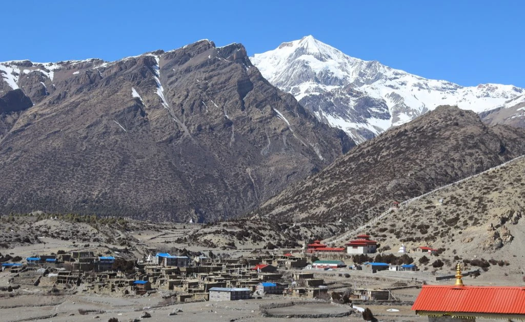
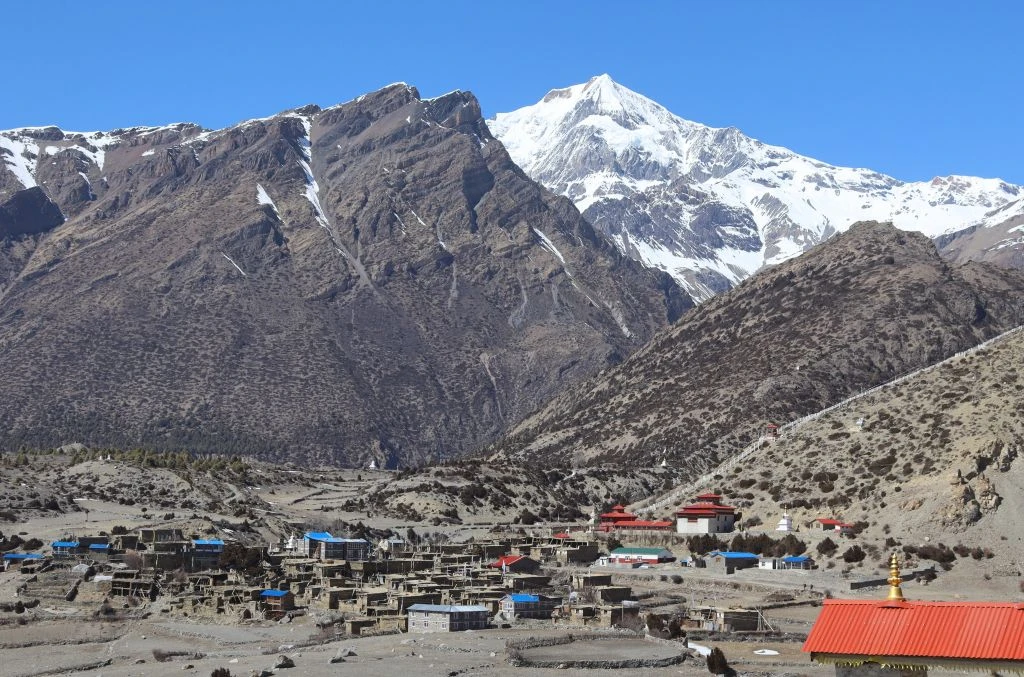
The Manange (or Nyeshyangba) people live in the highland desert-like landscape of the trans-Himalayan region stretching from Pisang (3,200 m) to Manang (3,540 m). This community’s traditional lifestyle is dictated by the climate and proximity to the Tibetan region, leading to the emergence of unique trans-border trade practices. Manang people practice Nyingma and Kagyu schools of Tibetan Buddhism and lead their existence in ancient cliffside monasteries, prayer wheels, and mani walls. Their existence is centered around the Bhraka (Braga) village, a complex of monasteries, and mani walls built from carved slates.
As one of the former royal trade monopolies, the inhabitants of Manang have long-standing commercial connections with Tibet, while their traditional nomadic lifestyle is centered around raising yaks and growing high-altitude crops. The visitor can get a close insight into the traditional trans-Himalayan lifestyle of the local community encapsulated within the wooden and stone flat-roofed architecture of the village.
 20 per person daily (in Nepalese Rupees - NPR).